Geotechnical: enhanced site evaluations
Our UAS service provides rapid and detailed site assessments and geophysical surveys, offering a higher-quality basis for design and analysis. By utilizing high-resolution optical, infrared and LiDAR sensors, we capture comprehensive site data that may be processed into numerous types of 2D and 3D models. These models are helpful for slope stability analyses, retaining wall designs and shoring designs, helping our engineers establish effective solutions.
Facilities: comprehensive building assessments
We offer high-quality site data and aerial imagery to supplement facility condition assessments and building envelope services. Our drones conduct virtual tours using 3D photospheres, roofing scans and infrared thermography for thermal loss and moisture issues. These capabilities allow for quick, non-disruptive assessment resulting in high-resolution imagery. This real-time data allows for immediate use in planning and design, helping you address current damage and get ahead of future developments.
Environmental: due diligence and natural resource support
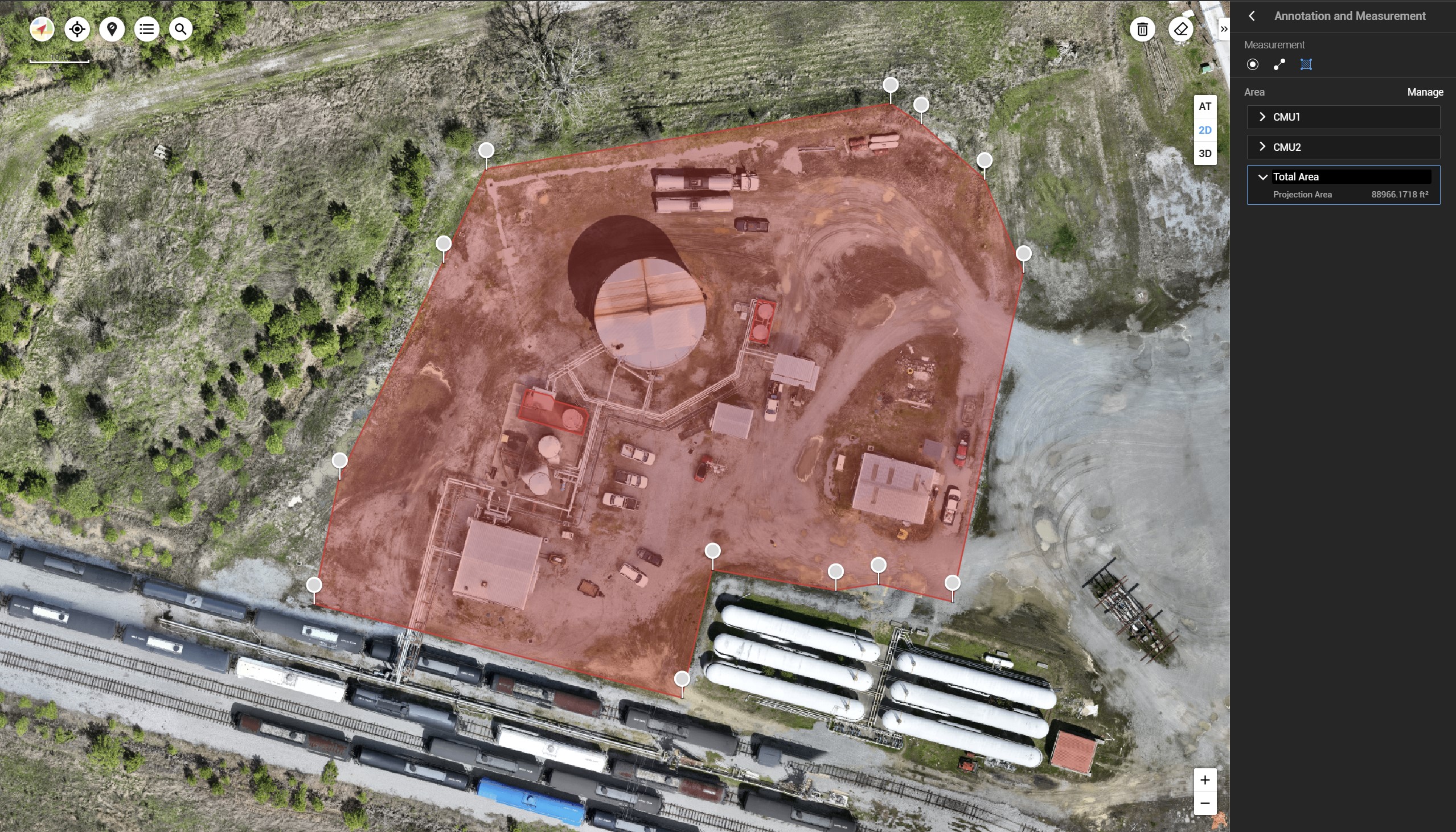
Our employed UAS are capable of performing large-property site reconnaissance, mapping and volume calculations for environmental site assessments (ESAs) and remediation progress monitoring. This provides detailed evaluations for environmental conditions and remediation efforts.
ECS also employs UAS to conduct preliminary wetland determinations, habitat mapping and long-term monitoring of construction sites and restoration projects. Using thermal imaging and detailed topographic surveys, we provide comprehensive environmental resource evaluations without disturbing natural habitats.
CONTACT US
Geotechnical: enhanced site evaluations
Our UAS service provides rapid and detailed site assessments and geophysical surveys, offering a higher-quality basis for design and analysis. By utilizing high-resolution optical, infrared and LiDAR sensors, we capture comprehensive site data that may be processed into numerous types of 2D and 3D models. These models are helpful for slope stability analyses, retaining wall designs and shoring designs, helping our engineers establish effective solutions.
Facilities: comprehensive building assessments
We offer high-quality site data and aerial imagery to supplement facility condition assessments and building envelope services. Our drones conduct virtual tours using 3D photospheres, roofing scans and infrared thermography for thermal loss and moisture issues. These capabilities allow for quick, non-disruptive assessment resulting in high-resolution imagery. This real-time data allows for immediate use in planning and design, helping you address current damage and get ahead of future developments.
Environmental: due diligence and natural resource support
Our employed UAS are capable of performing large-property site reconnaissance, mapping and volume calculations for environmental site assessments (ESAs) and remediation progress monitoring. This provides detailed evaluations for environmental conditions and remediation efforts.
ECS also employs UAS to conduct preliminary wetland determinations, habitat mapping and long-term monitoring of construction sites and restoration projects. Using thermal imaging and detailed topographic surveys, we provide comprehensive environmental resource evaluations without disturbing natural habitats.
CONTACT US